


Planning data is everywhere. Insight isn’t. Searchland’s Planning Tool turns 23 million+ applications into clear, usable intelligence - helping land and planning teams move faster, with confidence.
Planning intelligence shouldn’t feel this hard
If you’ve ever properly assessed a local authority before committing to a site, you’ll know how it usually goes.
You open the council portal.
You download documents individually.
You search manually for a keyword.
You realise you’ve missed related applications.
You try to estimate approval rates from memory.
It’s slow. It’s fragmented. And it rarely produces a complete picture.
The UK has decades of planning history. The issue isn’t availability - it’s accessibility. Every authority publishes data differently. Documents sit in isolated portals. Performance metrics have to be calculated manually. When deadlines tighten, teams fall back on instinct.
The hidden cost of fragmented planning data
The consequences of poor planning visibility aren’t dramatic. They’re incremental.
A team underestimates how an authority treats larger schemes.
A key appeal precedent goes unnoticed.
Decision timelines are misjudged by months.
Objection trends are missed until late in the process.
Individually, these feel manageable. Collectively, they shape risk - and margin.
Across SME developers, national housebuilders and planning consultants, we hear the same frustrations:
- Planning history scattered across 300+ council websites
- No consistent way to calculate approval rates
- Documents buried in PDFs with no searchability
- Difficulty comparing residential versus commercial performance
- No live alerts when applications update
- No spatial way to visualise trends
- Hours lost to repetitive manual research
When analysis doesn’t scale, strategy doesn’t scale either.
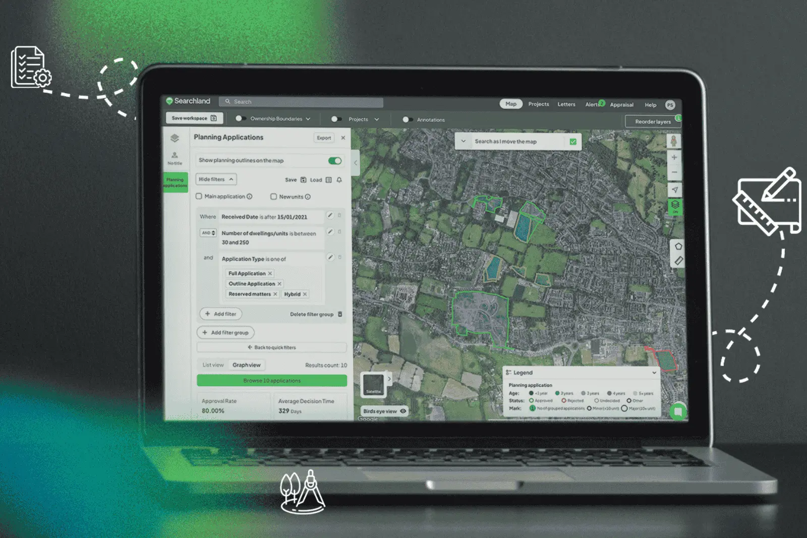
Introducing the Searchland Planning tool
Searchland provides 100% UK council coverage, with over 23 million planning applications dating back to 1990 - updated every 24 hours.
But coverage alone isn’t the point. What matters is how quickly you can turn that scale into decision-making confidence.
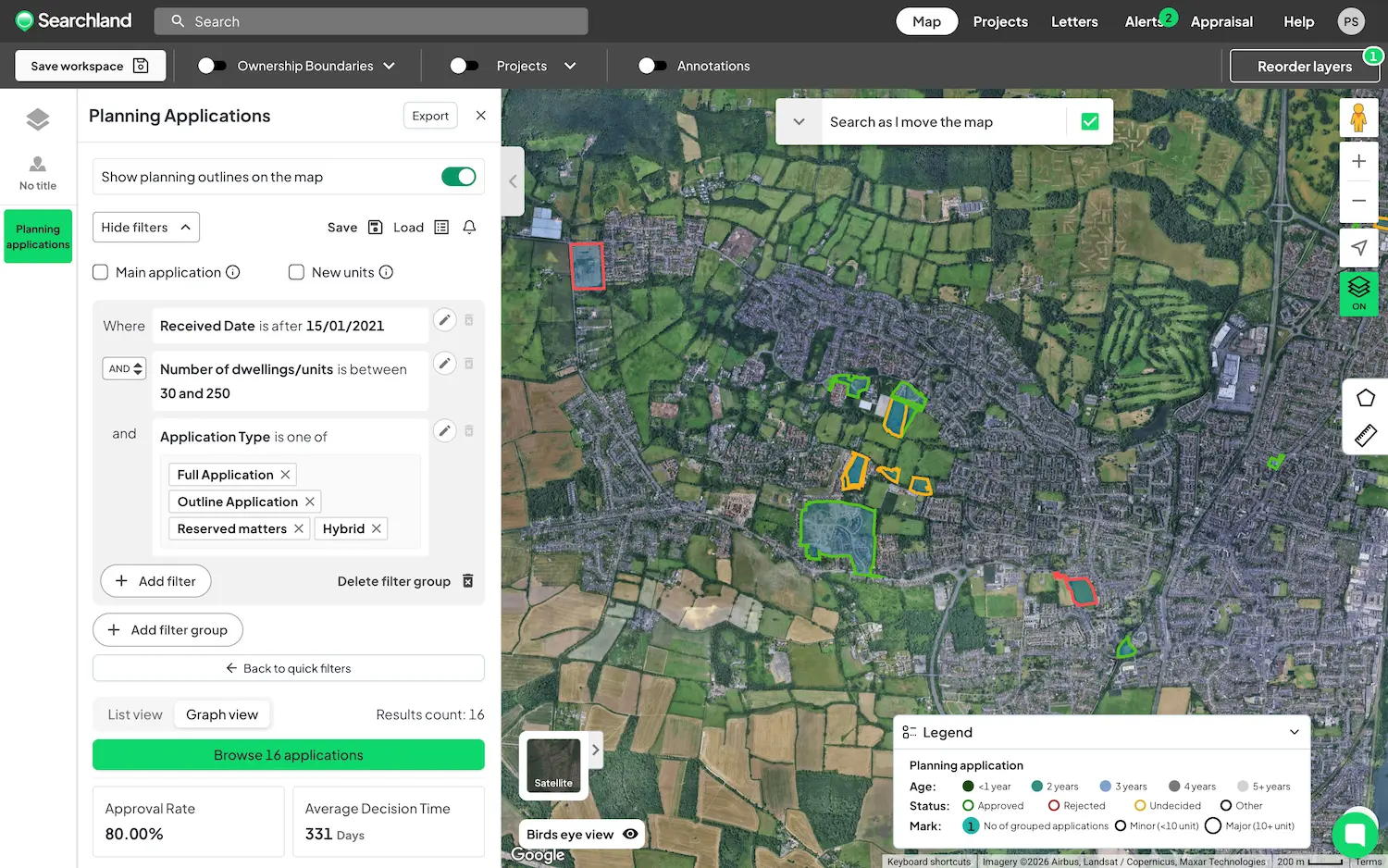
Instead of starting from scratch in a council portal, you can filter applications instantly - by use class, number of dwellings, agent, case officer, decision status or application type. If you’re investigating a specific issue, you can search directly inside associated documents for phrases like “Grey Belt”, “Biodiversity Net Gain” or “Nutrient Neutrality”.
No downloading. No manual scanning. No guesswork.
From individual decisions to measurable patterns
Planning isn’t about isolated applications. It’s about understanding behaviour.
With historic and live data in one place, you can calculate approval rates, compare major versus minor schemes, and assess residential against commercial performance. You can analyse actual decision timelines and filter by unit count or custom criteria to match your acquisition strategy. We'll even crunch the data for you, providing dynamic data dashboards that react as you develop your search - fully exportable for when you need to tell your story outside of Searchland.
That shift - from anecdotal understanding to quantified insight - changes how land teams operate. Internal discussions become evidence-led. Risk assessments become structured. Investment decisions become more defensible.
Documents that work like data
Planning documents often contain the most valuable insight - but they’re usually the hardest to interrogate.
Inside Searchland, documents are viewable in-app and searchable at scale. Thousands of documents can be scanned instantly for policy references, objections or precedent language. You can also set alerts so that when new documents are uploaded or an application status changes, your team is notified in real time.
Spatial clarity that spreadsheets can’t provide
Planning trends are geographical. They cluster. They reveal patterns visually.
Viewing filtered applications on a live map allows you to assess site-by-site performance, explore related applications and understand how surrounding schemes have progressed.
You can also stack planning constraints - Green Belt, Flood Zones, AONB, Conservation Areas, SSSI, Listed Buildings, Nutrient Neutrality, TPOs and more - and analyse how those constraints intersect with actual planning outcomes.
Because planning intelligence becomes far more powerful when it’s visual, spatial and connected to real-world acquisition decisions.
Connected to ownership, title and acquisition strategy
Planning data rarely exists in isolation. It informs land strategy, negotiations and risk modelling.
Within a single title view, you can move from planning history into ownership details, appeals, EPC records, sold price data and linked company ownership information.
The result isn’t just better planning research. It’s joined-up acquisition intelligence - where constraints, performance and ownership sit side by side.
Why this matters now
Planning complexity is increasing, not decreasing.
Policy reform, Biodiversity Net Gain requirements, infrastructure capacity constraints and ongoing housing delivery pressure are reshaping how authorities behave. The margin for assumption is shrinking.
The teams securing land confidently today are the ones who:
- Understand authority behaviour with evidence
- Quantify planning risk before committing capital
- Monitor changes in real time
- Standardise intelligence across regions
- Back strategy with data, not anecdote
That’s exactly what this tool is built to support.
See how your target authority really performs
If you want to cut hours from due diligence, quantify planning risk properly and move faster with clarity, the Searchland Planning Tool is designed for you.
Book a demo with our team and we’ll walk through your target local authority live - showing you how planning intelligence should actually work.


