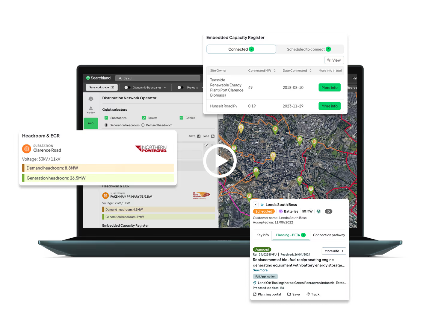

Uncover the scope of local energy networks
See all substations, power lines, EV chargepoint locations and towers in your area with our DNO data tool - everything you need for energy infrastructure planning.
Navigate electrical generation across the UK
Our Electrical Generation Tool brings the Embedded Capacity Register (ECR) into Searchland. Explore all connected and planned energy projects on an interactive, filterable map.

Filter substations, towers and lines
Search over 400,000 substations across the UK. Filter by distance to landmarks, voltage, and generation or demand headroom. Data is sourced from all six network operators and updated automatically.

Coverage from every provider mapped
See which network providers power which area of the country, and explore the transmission network across England, Scotland and Wales.

Voltage and headroom data with one click
Access substation tower and cable details to plan future infrastructure development. See demand and generation headroom clearly with our intuitive RAG status.

The Embedded Capacity Register (ECR)
Explore a visual and searchable map of connected and 'accepted to connect' energy projects around the UK. Filter energy projects by size (MW), date, energy source type and more.

Clean Power 2030 targets
Access NESO's clean power capacity targets across transmission and distribution networks, highlighting areas of opportunity for renewable projects in different regions.
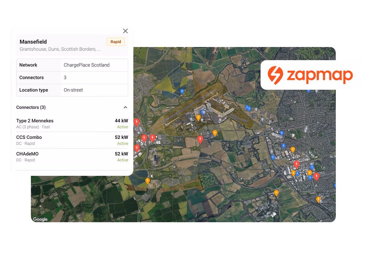
New: Map every EV charger in the UK
Plot every public EV charging location nationwide, powered by Zapmap - the UK's industry standard, and the data electric vehicles themselves use to find chargers in real time.


%203.svg)


%201.avif)