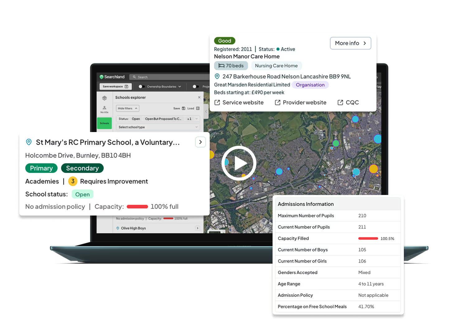

Understand local education at a glance
Explore every UK school, college, and university. Filter by type, level, Ofsted rating, and capacity to assess education provision for your development plans.
Map healthcare services with precision
View GP surgeries, hospitals, care homes, dentists, and social care centres. Ideal for planning residential and commercial developments with key local insights.

Access detailed education insights
See all local schools, colleges, and universities in your area. Check current capacity, available places, and filter by type, Ofsted rating, and education phase.

Dynamic infographics
Get an instant overview of any area's educational landscape with dynamic infographics, presenting key data in clear, easy-to-digest charts and graphs.

Advanced filters for in-depth data
Search over 30 datapoints - from gender split and inspection dates to age groups and pupil numbers - for a full picture of local education.

Explore local healthcare facilities
We've mapped essential healthcare services nationwide, including GPs, hospitals, dentists, and more.
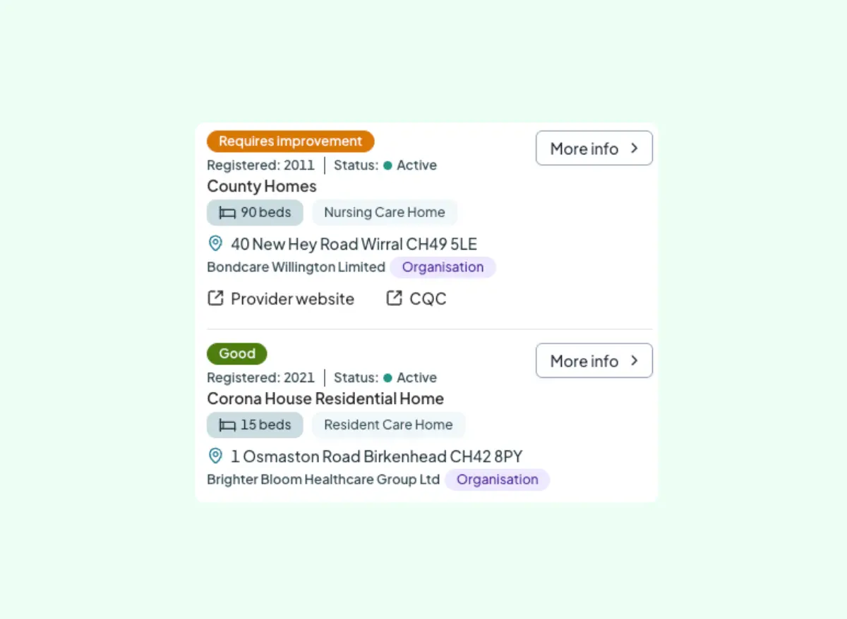
View all registered care homes ine UK
See the location of care homes and see crucial insights like CQC rating, status, number of beds and parent company.


%203.svg)


%201.avif)