
Searchland API
Ten property data APIs.
Unlimited possibilities.
Query the same authoritative UK datasets that power the Searchland platform - planning, ownership, constraints, value and infrastructure - straight from your own code.

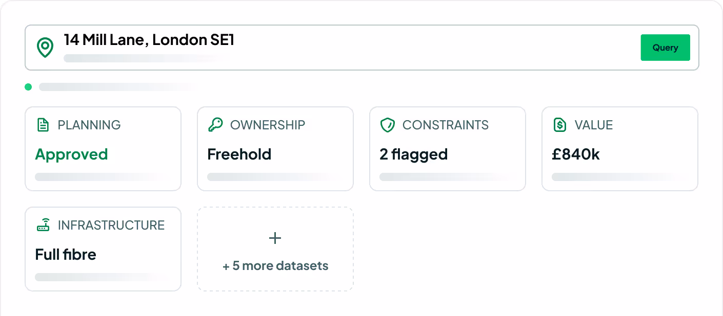
Powered by Ordnance Survey, HM Land Registry, Rightmove and more


%201.avif)


Planning Data updated every 24 hours, Rightmove data updated weekly & Policy data updated within 7 days of release.
Searchland API
From key to query.
01
Pick your endpoints
Choose the datasets you need from the catalogue — or take a bulk national download.
02
Authenticate
One API key, bearer auth. Sandbox keys for testing before you go live.
03
Query in real time
Consistent JSON, pagination and geometry across every endpoint.
Endpoint catalogue
Ten datasets, trusted by 2000 users
Every dataset that powers the Searchland platform, returned as clean JSON — consistent auth, pagination and geometry across the board.
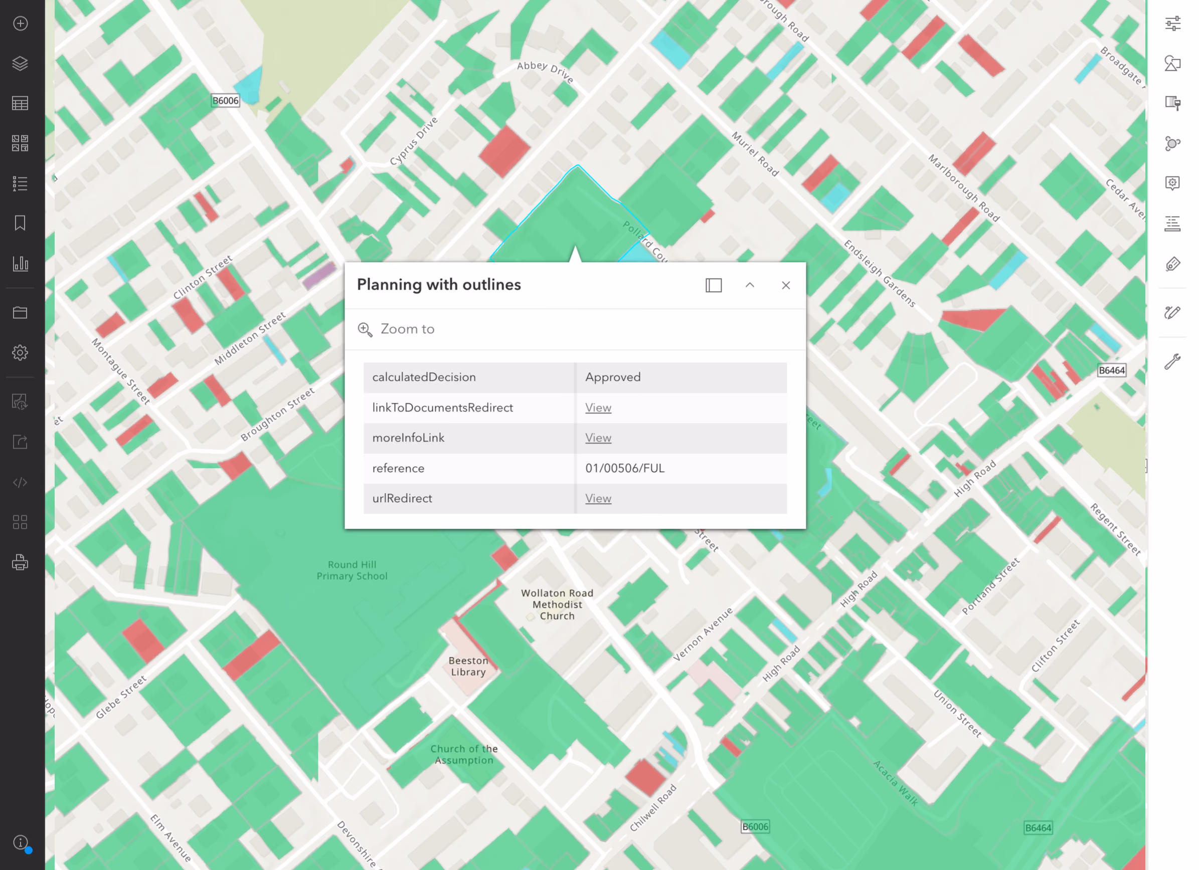
GIS integration
Drop live layers straight into ArcGIS or QGIS.
Stream Searchland datasets as spatial layers alongside your own — no exports, no manual refresh. Built for planning consultancies, infrastructure and research teams.
Choosing your route
API, platform or MCP?
Three ways into the same data. Pick by how your team works.
FAQ
Answers.
What is the Searchland API?

A way to access Searchland's national property and planning datasets programmatically, so the data lives inside your own systems, dashboards or applications — no platform UI required.
Do I need a Searchland licence to use the API?
No. API access is offered as a standalone, separately-priced service. A platform licence does not include API access, and the API does not require one.
What data can I access?
The same datasets that power the platform: planning applications & appeals, documents, ownership & title, constraints & policy, strategic land (SHLAA, allocations), energy & infrastructure, and sold-price comparables.
Bulk download, REST query, or GIS integration?
Bulk for large national datasets and internal databases. REST for real-time per-query access inside your software. GIS for spatial analysis directly in ArcGIS or QGIS alongside your own layers.
Can I buy Land Registry documents through the API?
Yes, we have integrated Land Registry document purchasing into our API structure.
Should I use the API or MCP?
Both reach the same Searchland data. Choose the API when you want to build it into your own software, pipelines or GIS programmatically. Choose MCP when you'd rather ask questions in natural language through an AI assistant like Claude or Copilot — no integration work, answers in seconds.
What are typical API use cases?
Pulling planning applications for a location into an internal deal-tracker, enriching your own GIS or analytics dashboards, building custom site-sourcing tools, or syncing ownership and constraints data into a database — anywhere you want Searchland data requested automatically by your own software.
Do I need a developer?
Yes — integrations involve writing code to query, process and store the responses. If your team has no technical resource, the platform is usually the better route.
Can I see a sample before buying?
Yes. We can share a sample dataset or schema overview so your technical team can confirm the structure fits before integrating.
We can’t wait to get you on board
Ready to access our data?
Our property data API is available as an off-the-shelf solution, or as a package tailored to your specific needs. Get in touch with us to start a conversation.