


Pinpoint high-traffic hotspots
Whether you're after a high-traffic city centre site or a busy out-of-town location, our footfall and traffic layers show real daily activity -anywhere in the UK.
Powerful search meets smart mobility data
Use our sourcing tool to quickly spot high-potential sites that match your mobility needs. Advanced spatial filters let you target areas with the right footfall and traffic.
.webp)
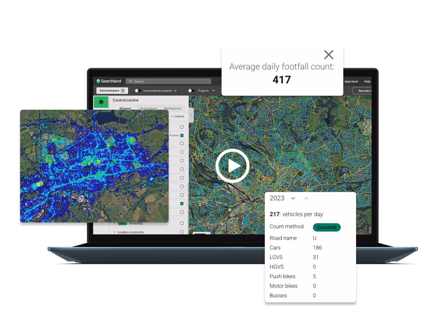
Visualise footfall across the UK
Explore our heatmap-style view of daily pedestrian activity. Navigate the map to uncover footfall stats and spot high- or low-traffic areas that match your goals.
.webp)
See traffic volumes at a glance
Use our traffic data layer to view vehicle volumes on roads across the UK. A clear visual key shows traffic levels, with interactive tools to reveal exact daily counts.
.webp)
Explore public transport options
Highlight nearby bus stops, train stations, and rapid transit links - giving you a clear view of transport connectivity around any site.
.webp)
Complete overview of road networks
Explore detailed maps of UK road networks -including motorways, A roads, B roads, and minor roads - to easily spot sites near key routes and amenities.

Adopted Highways data
We’ve centralised Adopted Highways data from councils across England and Wales -giving you the most complete view of road ownership, all in one place.


%201.avif)


-min.png)


%203.svg)


