
Boundaries API · UK administrative & geospatial data
Query any location, get its full boundary hierarchy.
Access administrative, political, postcode and geospatial boundaries in one standardised dataset. Query any location to instantly identify its boundary hierarchy — streamlining mapping, analysis and integration into your systems.
Our boundary tools are also available as part of a Searchland licence.

Greater London
Boundaries data that integrates with bespoke platforms & GIS
Our comprehensive boundaries API gives precise geographical data — enabling informed decisions, efficient resource allocation and compliance with local regulations, while improving your efficiency and user experience.
View our API documentsBoundary endpoints
Key API features.
Every boundary layer, from county down to parish — plus built-up areas and instant point lookup.
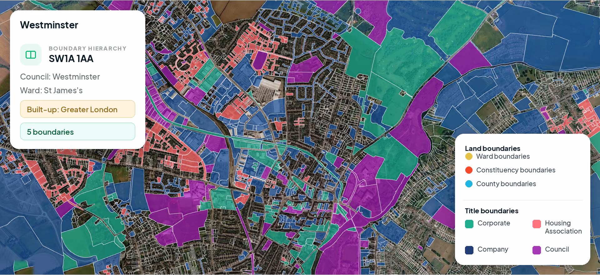
County boundaries
The larger administrative division within a country.
Council boundaries
Local government areas — essential for understanding municipal jurisdictions.
Ward boundaries
Subdivisions within a council area, used in electoral and administrative contexts.
Parish boundaries
The smallest unit of local government, relevant in rural and semi-rural areas.
Built-up areas
Urbanised or developed regions — essential for planning and development studies.
Constituencies
Parliamentary constituency boundaries for political and demographic analysis.
Regions
Statistical and administrative regions across the UK.
Postcode geometry
Postcode area, district and sector boundaries.
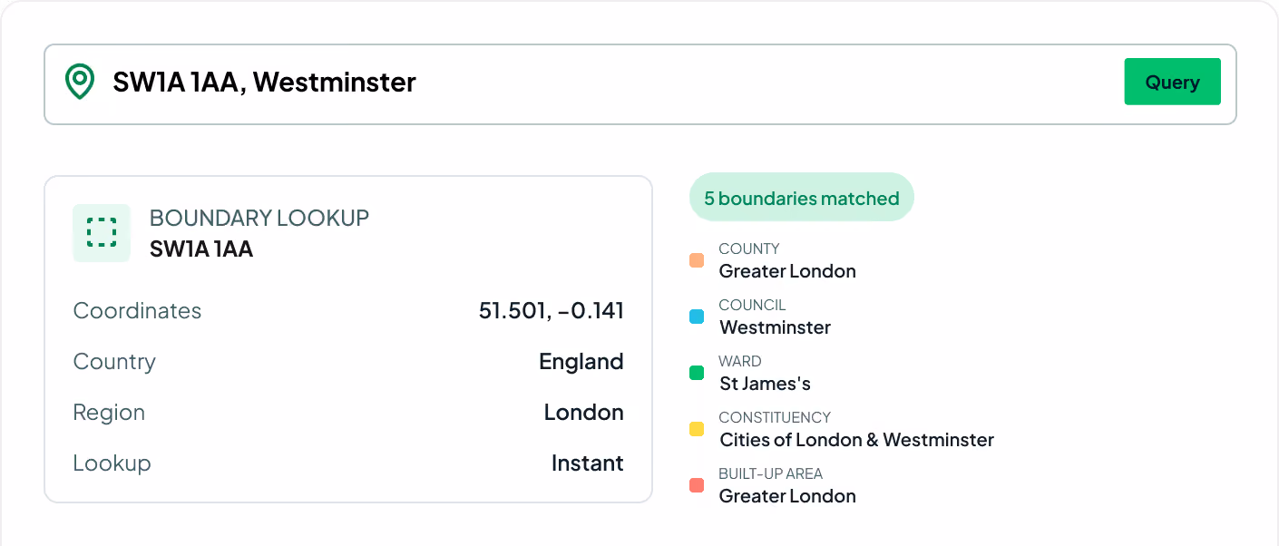
Hierarchy lookup
Query any point to instantly return its full boundary hierarchy.
.svg)
Enhanced strategic planning
Tailor business strategy, resource allocation and services to the specific geographic and administrative nuances of each region.
Streamline information gathering
Instead of navigating multiple sources and possibly outdated data, access up-to-date, comprehensive boundary information in one place.
Improved compliance
With accurate, up-to-date boundary information, ensure you're working within the policies and framework of the right local authority.
Request sample dataTrusted by the UK's leading developers


.avif)


Endpoint catalogue
More Searchland APIs.
The boundaries API is one of ten datasets behind the Searchland platform — every one available through the same clean, consistent API.
FAQ
Answers.
Which boundary types are included?

Ownership boundaries (England/Wales, plus Scotland), county, constituency, council, ward, parish, and built-up areas (2024). Of these, only settlement boundaries and built-up areas.
Which areas are covered?
Settlement boundaries cover England, Wales, and Scotland.
We can’t wait to get you on board
Ready to access our data?
Our property data API is available as an off-the-shelf solution, or as a package tailored to your specific needs. Get in touch with us to start a conversation.