
DNO API · Distribution Network Operators
Assess the viability of your energy infrastructure project in seconds.
Access live information from the UK's top six DNOs to locate substations, check available capacity, map cable routes and identify tower locations — helping you make informed, data-driven land decisions with confidence.

DNO data sources
DNO substations data that integrates with bespoke platforms & GIS
Get access to an in-depth array of DNO endpoints, including substation, tower and line locations, substation type, headroom rating, voltage, voltage group, tower type and operator information. Includes data from SSE, SPEN, WPD, ENWL, UKPN, NPG and National Grid.
View our API documents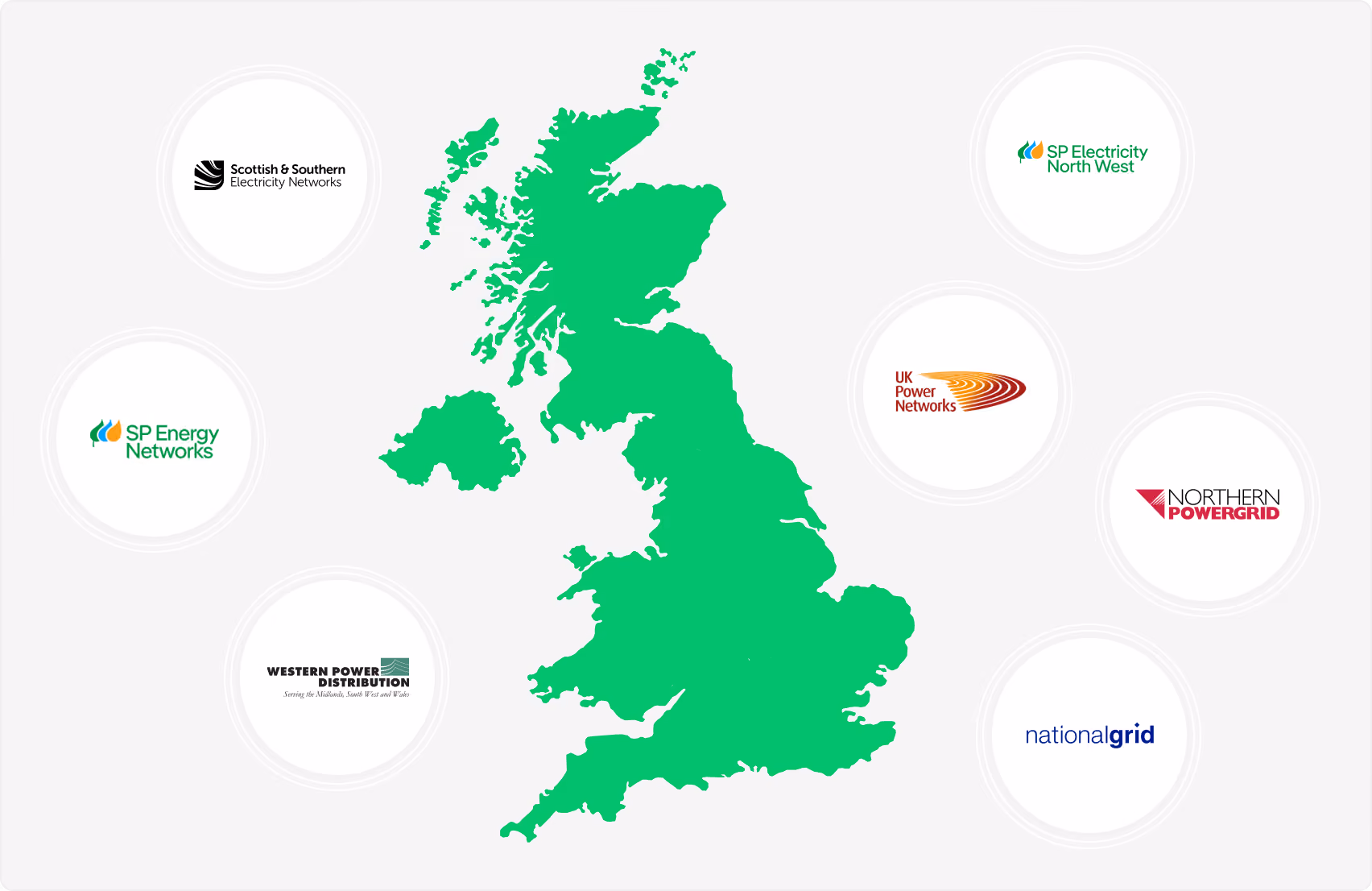
DNO endpoints
Key API features.
Every field that powers the Searchland DNO layer — consistent geometry and operator metadata across substations, towers and lines.
View our API documents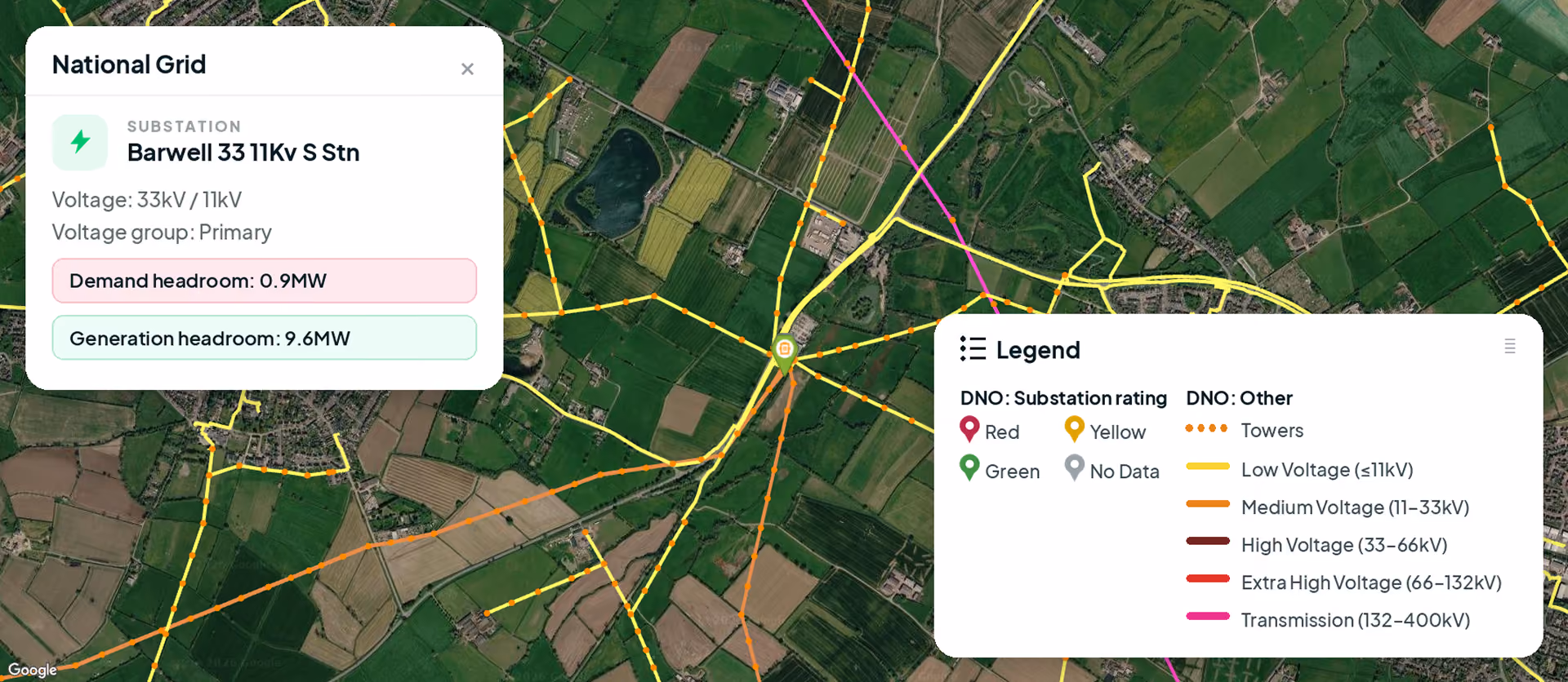
Substation locations
Pinpoint the exact locations of substations for strategic planning and analysis.
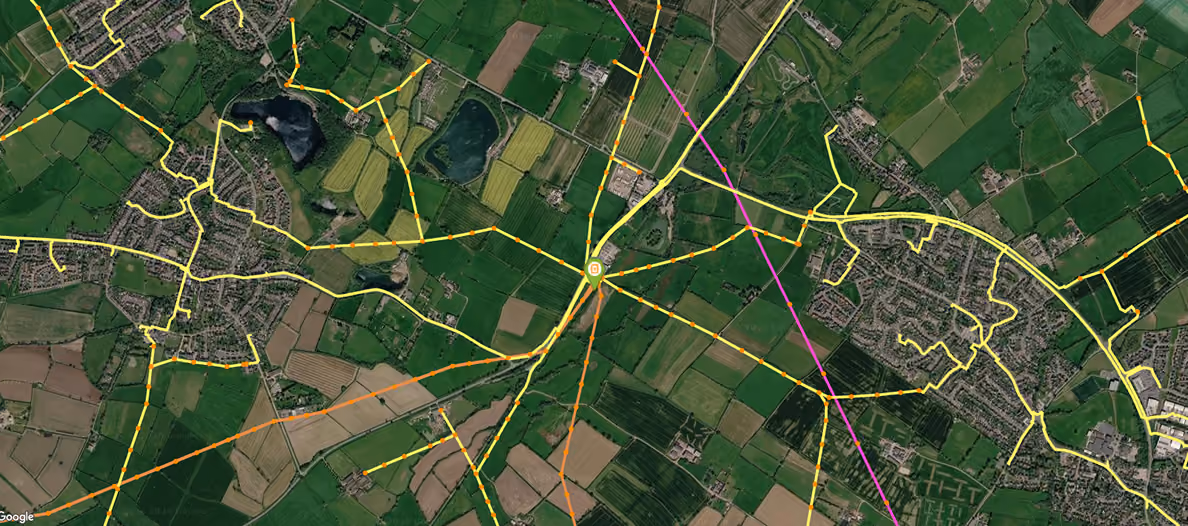
Tower & line locations
Positions of towers and lines, with voltage capacity and voltage group.
Substation type
Primary, grid or BSP classification to understand each site's role.
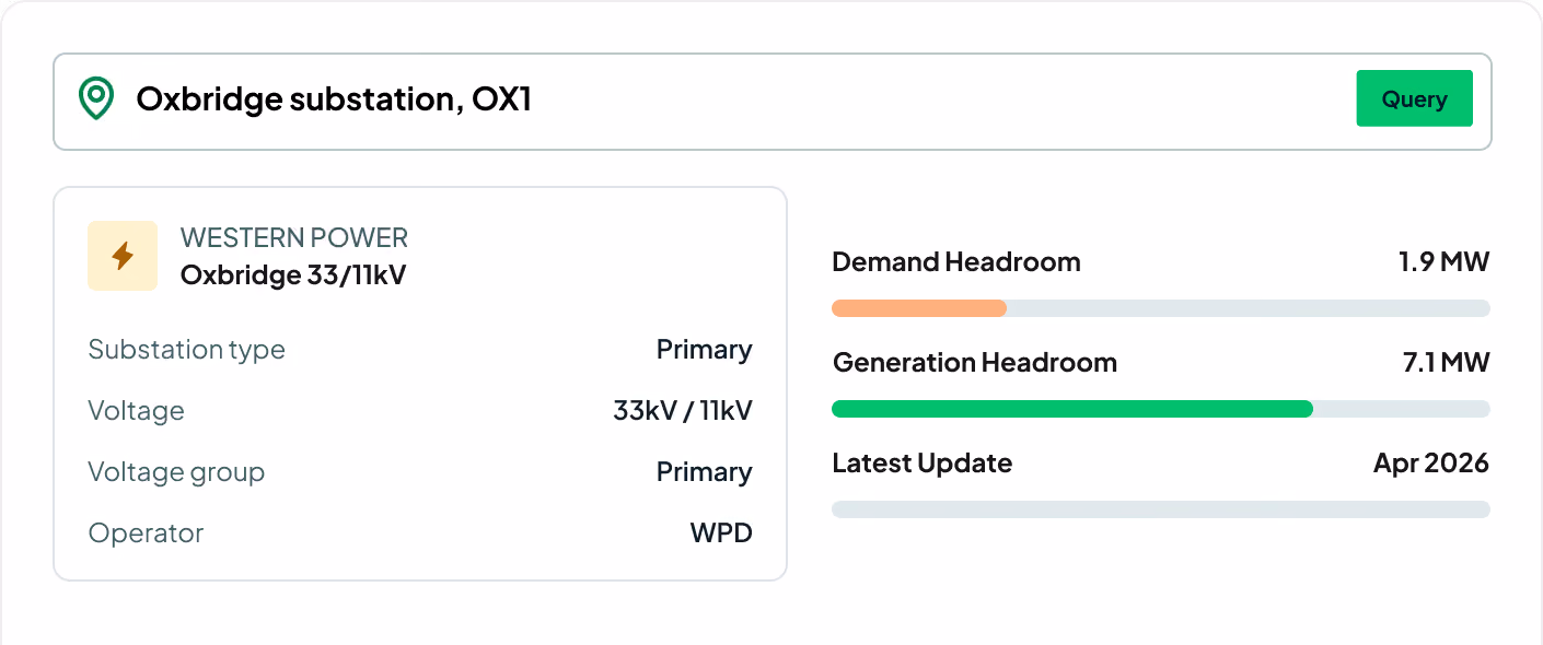
Headroom rating
Demand and generation headroom in MW, refreshed monthly.
Voltage details
Operating voltage levels at substations and network points.
Voltage group
Voltage-band classification for targeted power management.
Tower type
Pylon and support-structure types across the network.
Operator information
Owning DNO and network operator for coordination.
Capacity & cable routes
Available capacity and cable corridors for feasibility checks.
Make critical decisions faster
Access to accurate energy infrastructure data, instantly. Make more informed and strategic decisions regarding site selection, project feasibility and resource allocation.
Get an edge on the competition
Find sites that your competitors miss. Our DNO data is updated monthly, ensuring you have the most up-to-date access to substation locations and headroom capacity.
Enhance your existing software
Works with your current GIS software. Our API integrates smoothly, allowing you to consolidate all necessary data in one place — no need to adopt a new system.
Request sample dataTrusted by the UK's leading developers


Endpoint catalogue
More Searchland APIs.
The DNO API is one of ten datasets behind the Searchland platform — every one available through the same clean, consistent API.
FAQ
Answers.
What is the Searchland API?

A way to access Searchland's national property and planning datasets programmatically, so the data lives inside your own systems, dashboards or applications — no platform UI required.
Do I need a Searchland licence to use the API?
No. API access is offered as a standalone, separately-priced service. A platform licence does not include API access, and the API does not require one.
What data can I access?
The same datasets that power the platform: planning applications & appeals, documents, ownership & title, constraints & policy, strategic land (SHLAA, allocations), energy & infrastructure, and sold-price comparables.
Bulk download, REST query, or GIS integration?
Bulk for large national datasets and internal databases. REST for real-time per-query access inside your software. GIS for spatial analysis directly in ArcGIS or QGIS alongside your own layers.
Can I buy Land Registry documents through the API?
Yes, we have integrated Land Registry document purchasing into our API structure.
Should I use the API or MCP?
Both reach the same Searchland data. Choose the API when you want to build it into your own software, pipelines or GIS programmatically. Choose MCP when you'd rather ask questions in natural language through an AI assistant like Claude or Copilot — no integration work, answers in seconds.
What are typical API use cases?
Pulling planning applications for a location into an internal deal-tracker, enriching your own GIS or analytics dashboards, building custom site-sourcing tools, or syncing ownership and constraints data into a database — anywhere you want Searchland data requested automatically by your own software.
Do I need a developer?
Yes — integrations involve writing code to query, process and store the responses. If your team has no technical resource, the platform is usually the better route.
Can I see a sample before buying?
Yes. We can share a sample dataset or schema overview so your technical team can confirm the structure fits before integrating.
We can’t wait to get you on board
Ready to access our data?
Our property data API is available as an off-the-shelf solution, or as a package tailored to your specific needs. Get in touch with us to start a conversation.