
HMO data API · Houses in multiple occupation
Every licensed HMO in England and Wales, in one place.
Our HMO API unifies registers from every local authority in England and Wales into one trusted source — accurate, up-to-date insight on HMO properties nationwide. Fast, reliable and effortless to access.
Our HMO tool is also available as part of a professional Searchland licence.

HMO data sources
HMO data that integrates with bespoke platforms & GIS
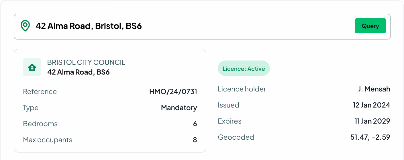
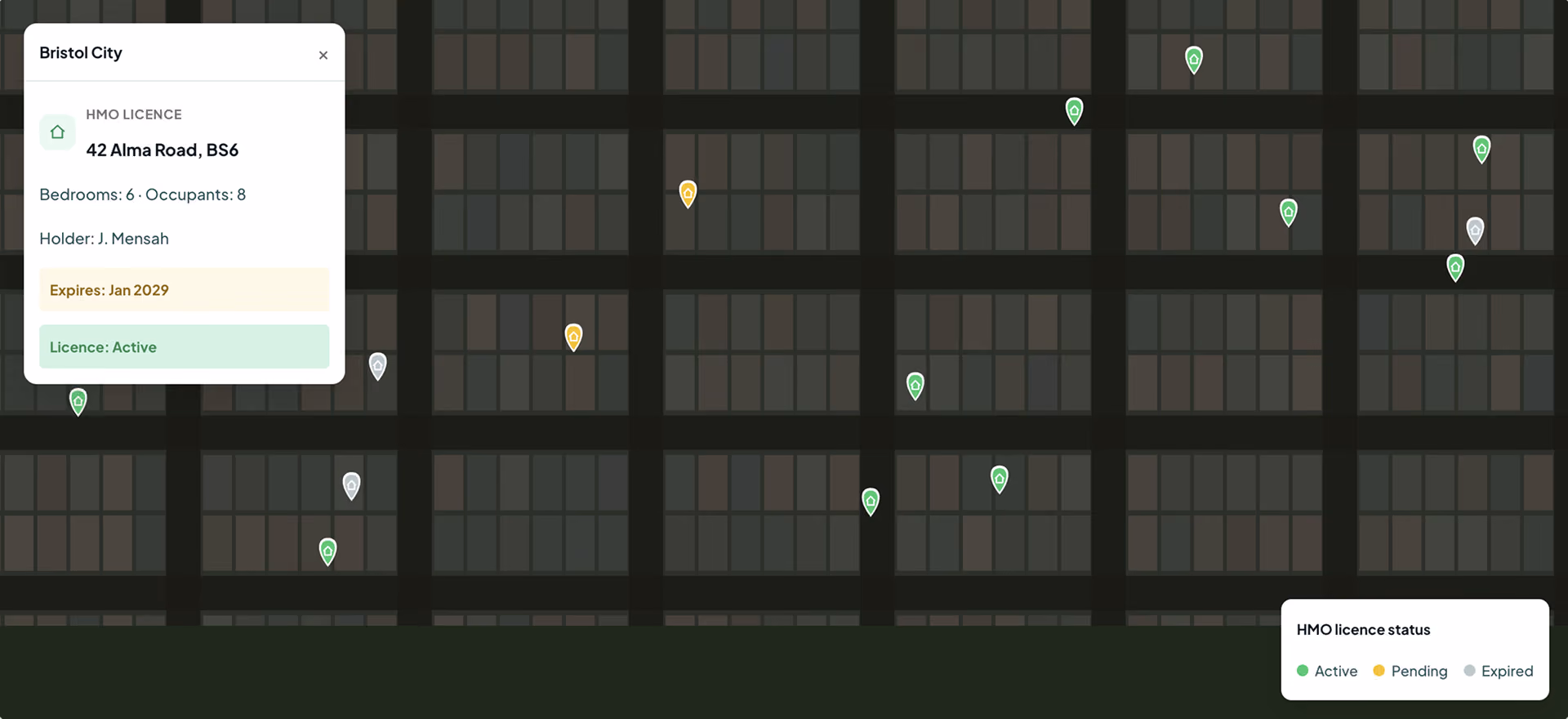
Before our API, gathering HMO data meant searching dozens of council websites and sifting through inconsistent PDFs and spreadsheets. Now everything is searchable in one place — licence holder name and address, licence start and end dates, the HMO address, number of bedrooms and the geocoded point.
View our API documentsHMO endpoints
Key API features.
Every field on the certificate — rating, potential, size, rooms and location.
Licence holder
Names and addresses of every HMO licence holder for outreach and due diligence.
Licence duration
The licence start and end dates for each HMO, so you know what's current.
Property address
The full address of each licensed house in multiple occupation.
Bedrooms
The number of bedrooms recorded for each licensed property.
Maximum occupants
The permitted occupancy attached to each HMO licence.
Geocoded location
A precise lat/long point for mapping every HMO accurately.
Local authority
The council that issued and maintains each licence record.
Licence status
Active, expired or pending status across the national register.
Licence reference
The council reference to track each licence end to end.

Efficient data retrieval
No more manual searches through dozens of council websites, or wrangling inconsistent PDFs and spreadsheets — it's all in one searchable place.
Up-to-date information
The API serves reliable, current licence data, so you always have the most accurate HMO information at your fingertips.
Improve strategic advantage
Use precise location data and property details for better planning and more strategic development across your projects.
Request sample dataTrusted by the UK's leading developers


Endpoint catalogue
More Searchland APIs.
The HMO API is one of ten datasets behind the Searchland platform — every one available through the same clean, consistent API.
FAQ
Answers.
Where does the HMO data come from?

We unify the public HMO licence registers from every local authority in England and Wales into one trusted, consistently formatted source — no more council-by-council searching.
Which areas are covered?
No. API access is offered as a standalone, separately-priced service. A platform licence does not include API access, and the API does not require one.
Do I need a Searchland licence to use the API?
The same datasets that power the platform: planning applications & appeals, documents, ownership & title, constraints & policy, strategic land (SHLAA, allocations), energy & infrastructure, and sold-price comparables.
Can I integrate the data with my own GIS?
Bulk for large national datasets and internal databases. REST for real-time per-query access inside your software. GIS for spatial analysis directly in ArcGIS or QGIS alongside your own layers.
What does each record include?
Yes, we have integrated Land Registry document purchasing into our API structure.
Can I see a sample before buying?
Yes. We can share a sample dataset or schema overview so your technical team can confirm the structure fits before integrating.
We can’t wait to get you on board
Ready to access our data?
Our property data API is available as an off-the-shelf solution, or as a package tailored to your specific needs. Get in touch with us to start a conversation.