
Planning applications API · UK planning data
Access real-time approvals, rejections and appeals across the UK.
Unlock planning application data from across the UK, updated in real time for the most accurate insight into new, ongoing and historic applications as they happen — from all UK councils, including Scotland if required.
Planning applications are also available as part of a Searchland licence.

Planning data sources
Planning application data that integrates with bespoke platforms & GIS
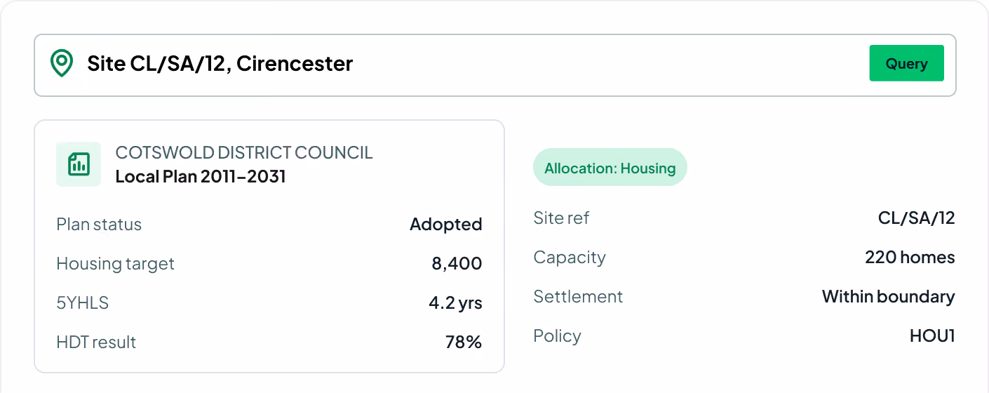
Access 100% of all planning application data published on council portals since 1990 — over 23.9 million applications — plus enriched appeals data totalling 500,000+ appeals with links to the inspectorate. Beyond the standard details we go deeper: applicants, key dates, decisions, development size, case officers and documents.
View our API documentsPlanning endpoints
Key API features.
Every field that powers the Searchland planning layer — consistent metadata across applications, decisions, appeals and documents.
Application type
Identify the specific type of each planning application for targeted searches.
Date received
The exact date each application was submitted, so your data is always timely.
Decision & date
The final decision — approved, rejected, pending — and the date it was issued.
Planning documents
Direct access to associated planning documents for comprehensive insights.
Case officer
The case officer assigned to each application, enabling more informed follow-ups.
Applicant & agent
The applicant and agent behind each scheme for outreach and due diligence.
Development size
Unit counts and the scale of the proposed development.
Appeals & inspectorate
Appeal outcomes with direct links to the Planning Inspectorate.
Application reference
Council reference and current status to track applications end to end.

Strategic decision making
By understanding the landscape of approvals, rejections and appeals, you know whether your project will succeed or fail at the first hurdle — before you commit.
Improve your application success rate
Application likely to go to appeal? Use historical data to turn the tide in your favour. Uncover statistical insights to back your case, or find applications that overcame objections.
Save time and resources
Streamline gathering and analysing planning data. Eliminate manual research, find everything you need in one place and reduce the likelihood of errors.
Request sample dataTrusted by the UK's leading developers


Endpoint catalogue
More Searchland APIs.
The planning applications API is one of ten datasets behind the Searchland platform — every one available through the same clean, consistent API.
FAQ
Answers.
Where does the planning data come from?

We aggregate 100% of all planning application data published on UK council portals since 1990 — over 23.9 million applications — enriched with 500,000+ appeals and direct links to the Planning Inspectorate.
How often is the planning data updated?
No. API access is offered as a standalone, separately-priced service. A platform licence does not include API access, and the API does not require one.
Do I need a Searchland licence to use the API?
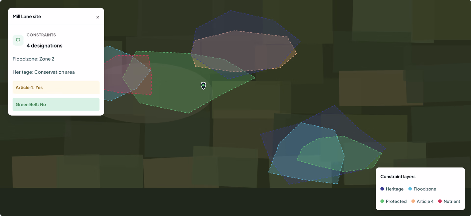
The same datasets that power the platform: planning applications & appeals, documents, ownership & title, constraints & policy, strategic land (SHLAA, allocations), energy & infrastructure, and sold-price comparables.
Can I integrate the data with my own GIS?
Bulk for large national datasets and internal databases. REST for real-time per-query access inside your software. GIS for spatial analysis directly in ArcGIS or QGIS alongside your own layers.
What does each record include?
Yes, we have integrated Land Registry document purchasing into our API structure.
Can I see a sample before buying?
Yes. We can share a sample dataset or schema overview so your technical team can confirm the structure fits before integrating.
We can’t wait to get you on board
Ready to access our data?
Our property data API is available as an off-the-shelf solution, or as a package tailored to your specific needs. Get in touch with us to start a conversation.