
Planning constraints API · UK development data
Uncover every barrier to development before you invest.
Navigate planning constraints across England, Wales and Scotland with precision. Get instant access to environmental and policy data — uncovering both temporary and permanent barriers to development before you commit.
Our planning constraints tools are also available as part of a Searchland licence.

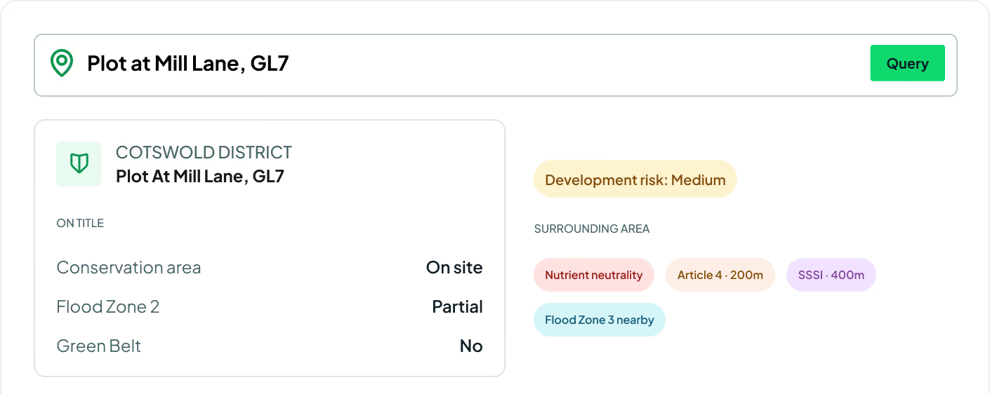
Planning constraints sources
Planning constraints data that integrates with bespoke platforms & GIS
Access many datasets covering planning constraints across England, Scotland and Wales — heritage constraints, natural and protected areas, flood zones, agricultural land, Article 4, nutrient land, Coal Authority data and London-only datasets.
View our API documentsConstraint endpoints
Key API features.
Every constraint layer behind the Searchland map — environmental and policy designations across England, Scotland and Wales.
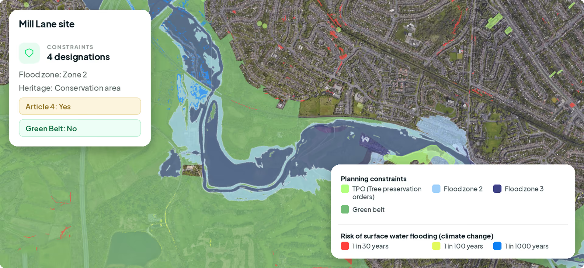
Heritage constraints
Comprehensive data on heritage site locations and the development restrictions they carry.
Natural & protected areas
Mapping and regulatory detail for national parks, reserves and conservation zones.
Flood zones
Extensive flood-risk data, including historical and predictive analysis by location.
Agricultural land
Land quality, agricultural potential and the development policies tied to each grade.
Article 4 directions
Local Article 4 directives and how they restrict permitted development rights.
Nutrient insights
Nutrient neutrality requirements and mitigation strategies for development projects.
Coal Authority data
Past mining activity, subsidence risks and coal mining regulations.
Green Belt & policy
Green Belt boundaries and local policy designations that limit development.
London-only datasets
Specialised datasets tailored to London's unique planning and development landscape.
.svg)
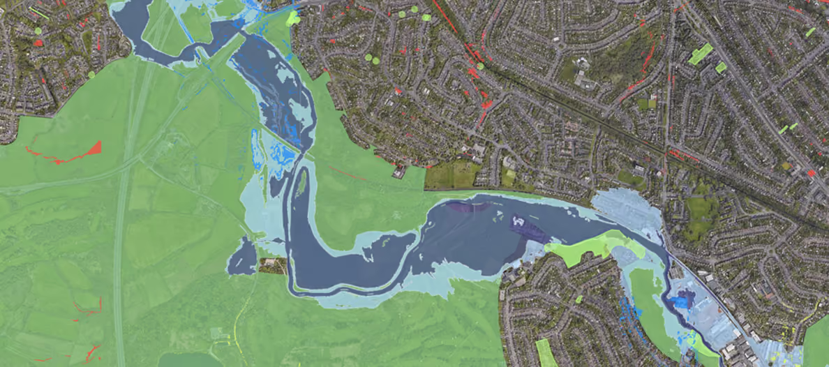
Make decisions with confidence
With a vast array of data on environmental and policy constraints at hand, you can make more informed decisions about land development opportunities.
Speed up information gathering
Instead of navigating multiple sources and possibly outdated data, access up-to-date, comprehensive planning constraint information in one place.
Improve strategic advantage
Identify opportunities that others might overlook, and avoid areas with high risk or excessive planning limitations.
Request sample dataTrusted by the UK's leading developers










Endpoint catalogue
More Searchland APIs.
The planning applications API is one of ten datasets behind the Searchland platform — every one available through the same clean, consistent API.


FAQ
Answers.
Which constraints does the API cover?

The API spans heritage constraints, natural and protected areas, flood zones, agricultural land, Article 4 directions, nutrient neutrality, Coal Authority data, Green Belt and London-only datasets.
Which nations are covered?
No. API access is offered as a standalone, separately-priced service. A platform licence does not include API access, and the API does not require one.
Do I need a Searchland licence to use the API?
The same datasets that power the platform: planning applications & appeals, documents, ownership & title, constraints & policy, strategic land (SHLAA, allocations), energy & infrastructure, and sold-price comparables.
Can I integrate the data with my own GIS?
Bulk for large national datasets and internal databases. REST for real-time per-query access inside your software. GIS for spatial analysis directly in ArcGIS or QGIS alongside your own layers.
What does each record include?
Yes, we have integrated Land Registry document purchasing into our API structure.
Can I see a sample before buying?
Yes. We can share a sample dataset or schema overview so your technical team can confirm the structure fits before integrating.
We can’t wait to get you on board
Ready to access our data?
Our property data API is available as an off-the-shelf solution, or as a package tailored to your specific needs. Get in touch with us to start a conversation.