
Planning constraints API · UK development data
Find developable land before it's allocated.
Access detailed insights from Local Authorities across England — housing and employment site allocations, dwelling capacity and delivery timeframes — so developers and planners can evaluate land potential and forecast development pipelines with precision.
Our SHLAA datasets are also available as part of a Searchland licence.

SHLAA data sources
SHLAA data that integrates with bespoke platforms & GIS
Our SHLAA API includes an array of data endpoints — decision status and group, site address, number of dwellings, decision reason, delivery timescale and more.
View our API documentsSHLAA endpoints
Key API features.
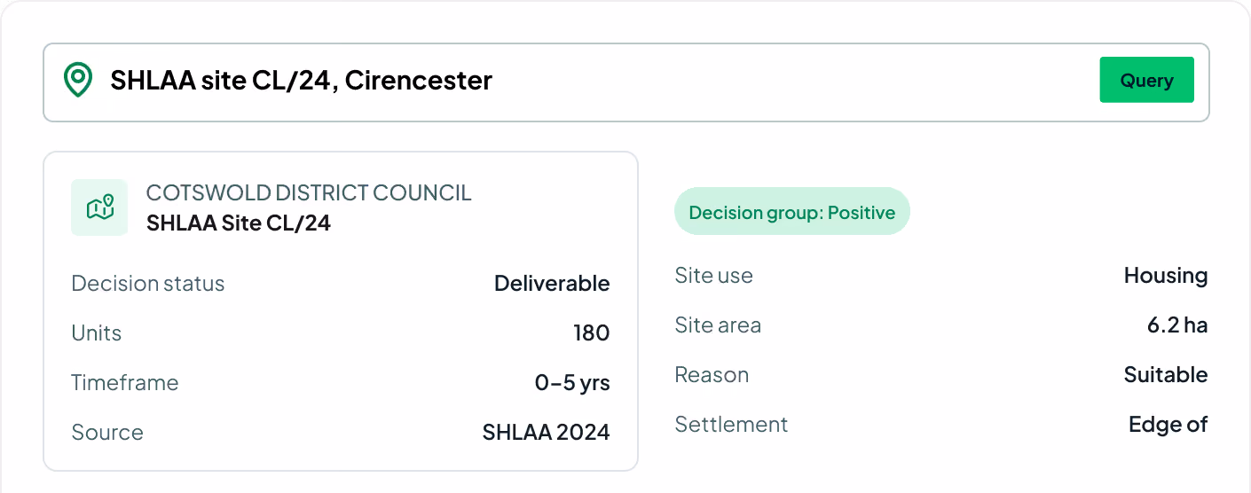
Every field on the SHLAA assessment — decision status, group, capacity, timeframe and source across England.
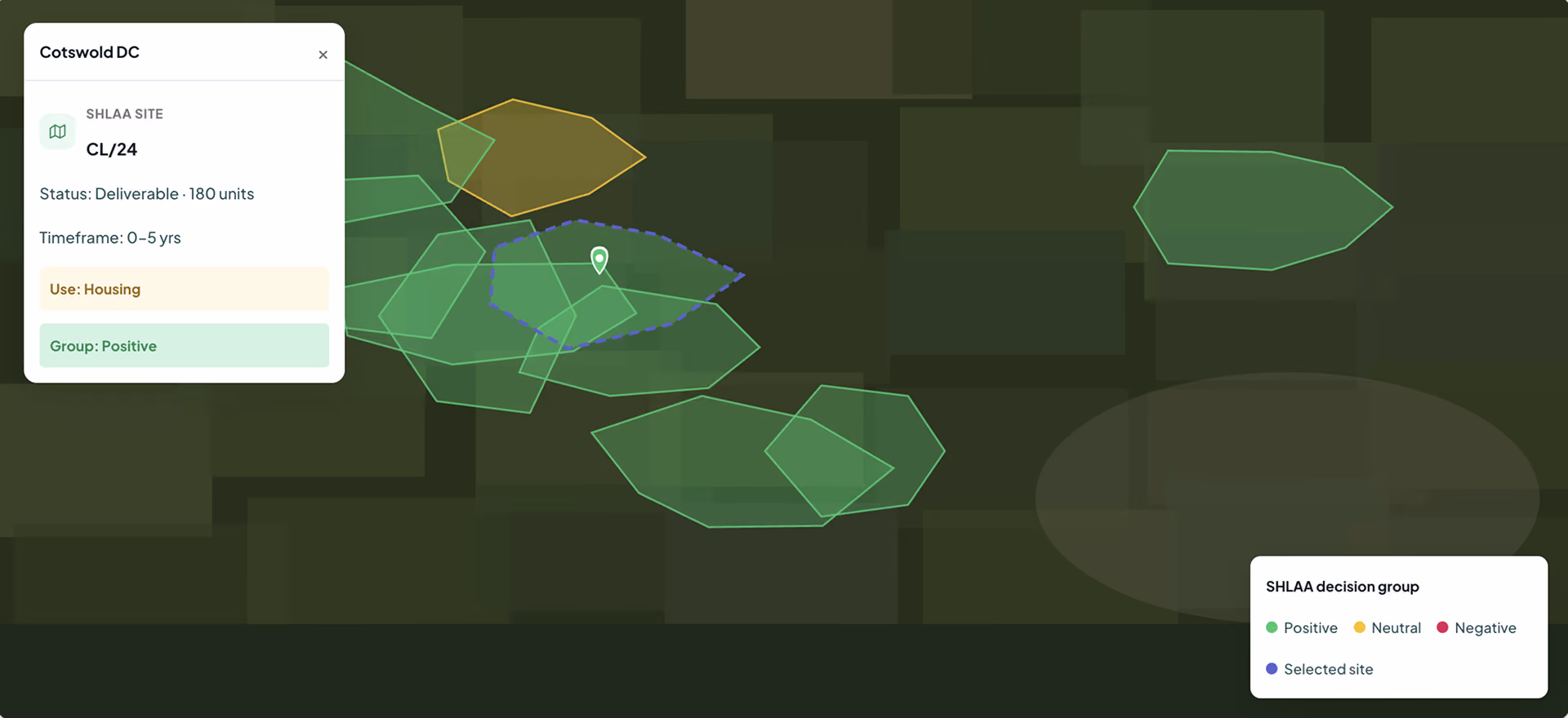
Decision status
Developable, not-developable, deliverable and suitable criteria for each SHLAA site.
Decision group
The assessment result for each site — positive, neutral or negative.
Units
How many dwellings can be accommodated on each identified site.
Timeframe
When each site is likely to become available for development.
Decision reason
A summary of why the decision was reached — and whether land suits housing or employment.
Source
The initial data source behind each SHLAA record.
Site address
The address and location of every assessed site.
Site use
Housing or employment land-use classification for each site.
Site area
The size of each assessed parcel of land.

Strategic decision making
By understanding SHLAA assessments, you get a clearer view of whether a site meets the needs of the local area — improving your chances of a successful application.
Standardised data
We've all wrestled with hit-and-miss council portals and clunky websites. Find every dataset you need — enhanced, cleansed and centralised.
Save time and resources
Streamline gathering and analysing SHLAA data. Eliminate manual research, find everything in one place and reduce the likelihood of errors.
Request sample dataTrusted by the UK's leading developers


Endpoint catalogue
More Searchland APIs.
The planning constraints API is one of ten datasets behind the Searchland platform — every one available through the same clean, consistent API.
FAQ
Answers.
What does the SHLAA API cover?

The API spans decision status and group, number of dwellings, delivery timeframe, decision reason and source — plus the site address for every assessed parcel.
Which areas are covered?
No. API access is offered as a standalone, separately-priced service. A platform licence does not include API access, and the API does not require one.
Do I need a Searchland licence to use the API?
The same datasets that power the platform: planning applications & appeals, documents, ownership & title, constraints & policy, strategic land (SHLAA, allocations), energy & infrastructure, and sold-price comparables.
Can I integrate the data with my own GIS?
Bulk for large national datasets and internal databases. REST for real-time per-query access inside your software. GIS for spatial analysis directly in ArcGIS or QGIS alongside your own layers.
What do decision status and group mean?
Yes, we have integrated Land Registry document purchasing into our API structure.
Can I see a sample before buying?
Yes. We can share a sample dataset or schema overview so your technical team can confirm the structure fits before integrating.
We can’t wait to get you on board
Ready to access our data?
Our property data API is available as an off-the-shelf solution, or as a package tailored to your specific needs. Get in touch with us to start a conversation.