
Sold price API · UK property sales data
Every sale price in England and Wales, straight from the source.
Access final sale prices straight from HM Land Registry, with essential property details including type, EPC rating and status. Built for real estate professionals who need reliable, structured market data for analysis and decisions.
Our property sales tools are also available as part of a Searchland licence.

Sold price sources
Sold price data that integrates with bespoke platforms & GIS
Our API includes an array of endpoints — sold price, sale date, property type, parking status, the current and potential EPC rating and more — giving a complete picture of property transactions across England and Wales.
View our API documentsSold price endpoints
Key API features.
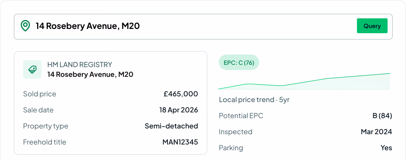
Every field on the transaction record — price, date, property type, EPC and freehold title.
Sold price
The final sale price of the property, essential for valuation and market-trend analysis.
Sale transfer date
The date of the property transaction, for tracking market activity over time.
Property type
The category of property — residential or commercial — for targeted market analysis.
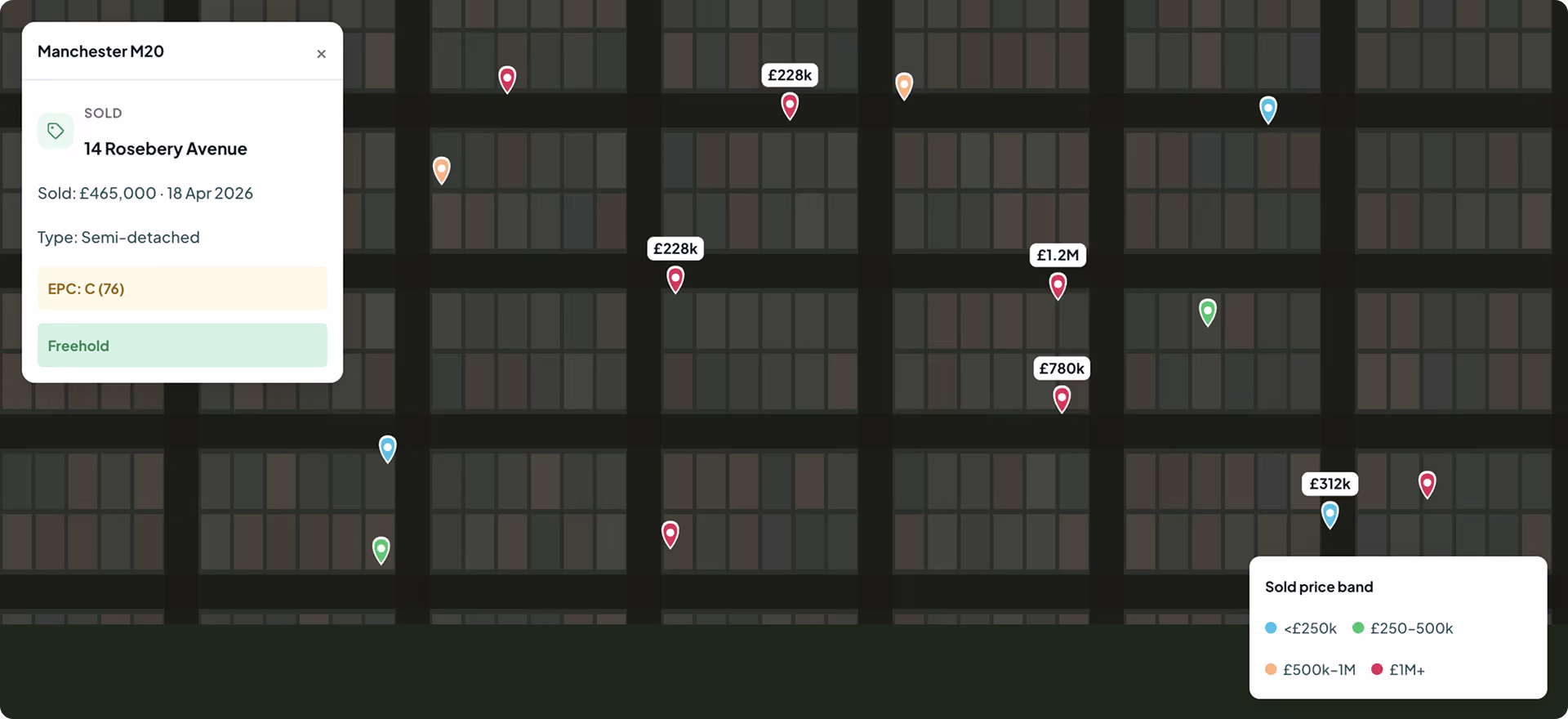
Geocoded point
The exact geographic location of the property for precise mapping and spatial analysis.
Current EPC rating
The current Energy Performance Certificate rating, for assessing energy efficiency.
EPC inspection date
When the property's energy performance was last assessed — the currency of the rating.
Potential EPC rating
The possible rating after recommended improvements, for future efficiency planning.
Freehold title number
The unique identifier for the property's freehold status — legal and ownership clarity.
Parking status
Whether the property has associated parking, useful for valuation context.

Comprehensive property data
Price-paid data covers all property sales in England and Wales, giving an accurate, comprehensive overview of market activity.
Streamline information gathering
Instead of navigating multiple sources and possibly outdated data, access up-to-date sold price and property information in one place.
Market insight and strategy
With historical sale prices and dates at hand, sharpen your toolset for more effective market analysis and trend prediction.
Request sample dataTrusted by the UK's leading developers


Endpoint catalogue
More Searchland APIs.
The sold price API is one of ten datasets behind the Searchland platform — every one available through the same clean, consistent API.
FAQ
Answers.
Where does the sold price data come from?

Sold prices come straight from HM Land Registry's price-paid data, covering residential and commercial transactions across England and Wales.
How far back does the data go?
No. API access is offered as a standalone, separately-priced service. A platform licence does not include API access, and the API does not require one.
Do I need a Searchland licence to use the API?
The same datasets that power the platform: planning applications & appeals, documents, ownership & title, constraints & policy, strategic land (SHLAA, allocations), energy & infrastructure, and sold-price comparables.
Can I integrate the data with my own GIS?
Bulk for large national datasets and internal databases. REST for real-time per-query access inside your software. GIS for spatial analysis directly in ArcGIS or QGIS alongside your own layers.
What does each record include?
Yes, we have integrated Land Registry document purchasing into our API structure.
Can I see a sample before buying?
Yes. We can share a sample dataset or schema overview so your technical team can confirm the structure fits before integrating.
We can’t wait to get you on board
Ready to access our data?
Our property data API is available as an off-the-shelf solution, or as a package tailored to your specific needs. Get in touch with us to start a conversation.