
Title & ownership API · UK property data
Know who owns every plot, and where the boundaries lie.
Access nationwide property intelligence — ownership details, tenure type, boundary outlines, building footprints and development potential. Built for developers, agents and investors who need fast, accurate data for confident decisions.
Our title and ownership tools are also available as part of a Searchland licence.

Title & ownership sources
Title boundaries and ownership data that integrates with bespoke platforms & GIS
More than a data portal, our API is your gateway to informed, data-driven property decisions. Endpoints cover property classifications, plot sizes, percentage of area developed, address and location, ownership details, date added by proprietor and many more.
View our API documentsTitle endpoints
Key API features.
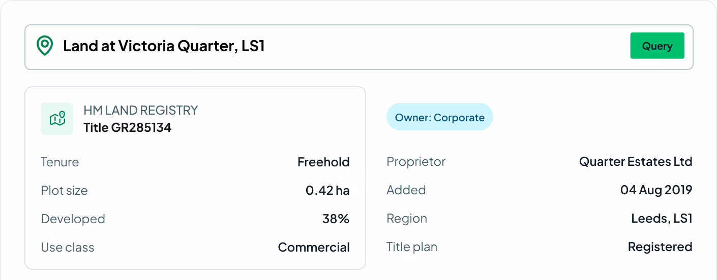
Every field on the registered title — classification, ownership, tenure, plot geometry and development.
Property classification
The type and use category of each property at a glance.
Address, postcode & region
Precise location details, including coordinates where available.
Plot size
The exact dimensions and area of each registered title.
Percentage developed
How much of the plot is currently developed or utilised.
Ownership details
Comprehensive information on the current owner(s) of the property.
Date added by proprietor
When the current owner added the property to their portfolio.
Tenure type
Freehold or leasehold tenure for every registered title.
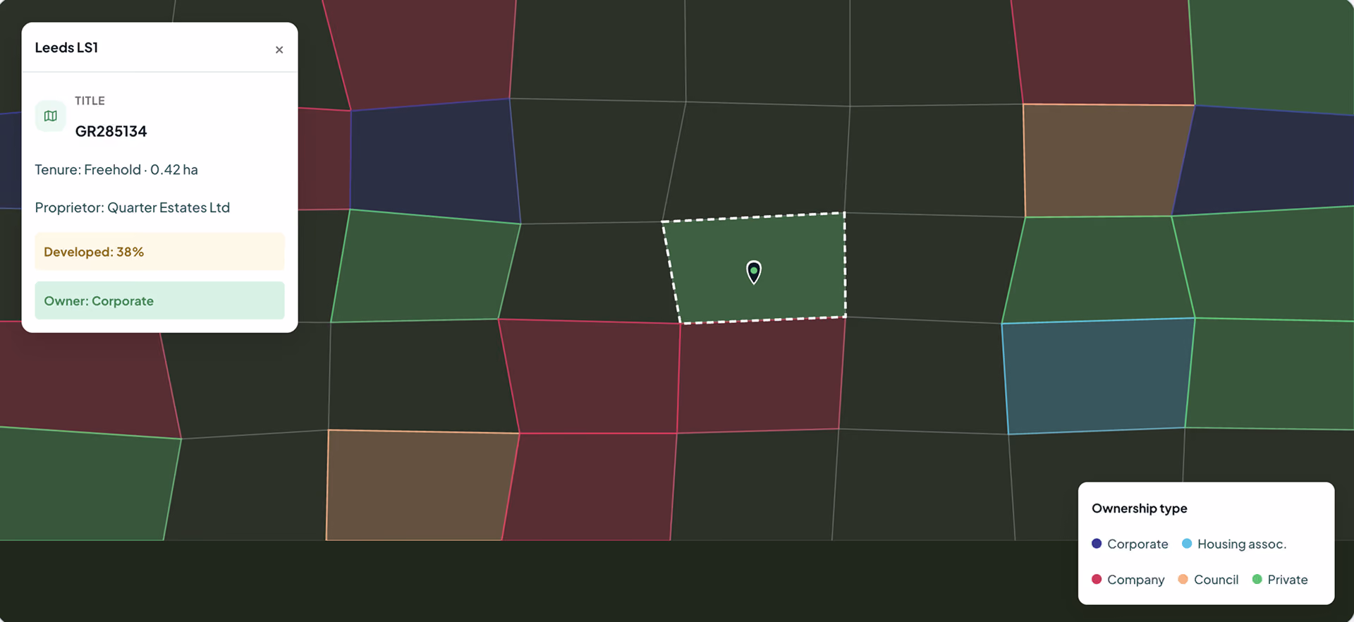
Boundary outline
Registered title boundary geometry and building footprints.
Proprietor type
Corporate, company, housing association, council or private owner.

Efficient property analysis
Streamline gathering comprehensive property data — ownership, plot size and building information — for quicker, more efficient analysis of potential development sites.
Mitigate risk
Assess and mitigate legal and regulatory risks. Understanding these aspects upfront saves the time and resources you'd otherwise spend on unforeseen compliance issues.
Enhance your existing software
Gain deeper insight into market trends and property types — crucial for strategic planning and identifying lucrative development opportunities.
Request sample dataTrusted by the UK's leading developers


Endpoint catalogue
More Searchland APIs.
The title and ownership API is one of ten datasets behind the Searchland platform — every one available through the same clean, consistent API.
FAQ
Answers.
Where does the title and ownership data come from?

We draw on registered title and ownership data covering England and Wales — property classifications, ownership, tenure and registered boundary geometry — unified into one consistent API.
Which areas are covered?
No. API access is offered as a standalone, separately-priced service. A platform licence does not include API access, and the API does not require one.
Do I need a Searchland licence to use the API?
The same datasets that power the platform: planning applications & appeals, documents, ownership & title, constraints & policy, strategic land (SHLAA, allocations), energy & infrastructure, and sold-price comparables.
Can I integrate the data with my own GIS?
Bulk for large national datasets and internal databases. REST for real-time per-query access inside your software. GIS for spatial analysis directly in ArcGIS or QGIS alongside your own layers.
What owner types can I identify?
Yes, we have integrated Land Registry document purchasing into our API structure.
Can I see a sample before buying?
Yes. We can share a sample dataset or schema overview so your technical team can confirm the structure fits before integrating.
We can’t wait to get you on board
Ready to access our data?
Our property data API is available as an off-the-shelf solution, or as a package tailored to your specific needs. Get in touch with us to start a conversation.